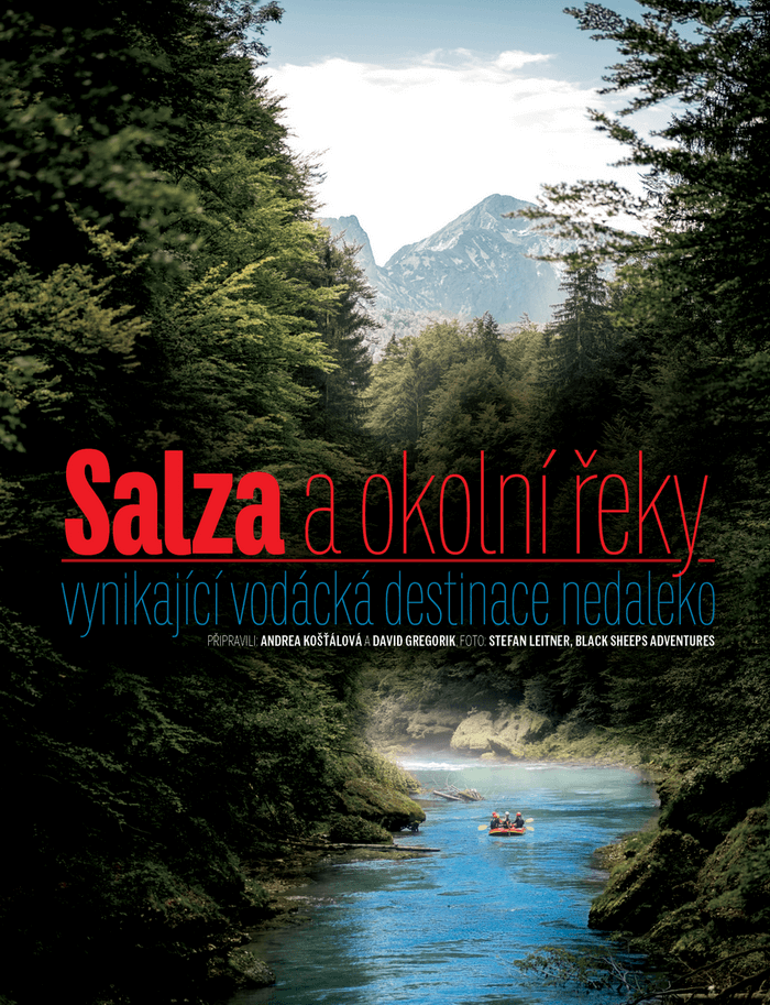
Salza – a pearl among Austrian rivers

Photo: Stefan Leitner
The Salza River – few paddlers have not heard of it. It is located in northern Styria and divides the Hochschwab and the Göstling Alps with its course. It rises near the pilgrimage site of Mariazell below the Ulreichsberg at an altitude of about 1800 metres above sea level. It is 80 km long and flows into the river Enns. Clear water like this is rarely found anywhere today.
From the source to the Gusswerk, the Salza is more like a stream, so it is uninteresting for paddlers. From the village of Gusswerk to the confluence with the Enns, 60 km of unforgettable experiences await paddlers.
Gusswerk – Prescenyklause dam (Klausgraben)
WW I-II (15 km)
After the village of Gusswerk, the first, lesser-known section begins. The Salza follows the road at first, but after a few kilometres it breaks off and winds through a beautiful canyon. There are plenty of places in the canyon where water hits undercut rocks, and you should also be careful of fallen trees.
The Salza is a beautiful river for the general boating public. Both beginner and professional paddler will find their own. However, it is important not to underestimate the equipment or the water conditions. We have been working as rafting guides on the Salza for sixth season and unfortunately we constantly meet (mostly Czechs) without helmets, without vests, without wetsuits, riding in flood conditions. It is in these cases that fatal accidents happen. So please, do not underestimate this river and set an example for others!
Suitable equipment: helmet, Neoprene long john, neoprene or spritz jacket, vest, neoprene boots, throwing bag, first aid.
Water status: www.ennskraft.at/system/web/pegelwerte.aspx?stelle=5&menuonr=50406231
ATTENTION! The water level is measured in Wildalpen. Many other rivers flow into the Salza before the gorge and therefore this condition is purely indicative and should not be used as a basis for judging the navigability of the entire river. If in doubt, consult your local boaters!

Black Sheeps Adventures KG, www.black-sheeps.eu
Prescenyklause – Dam, confluence with the Enns
The next section starts below the Prescenyklause dam. If one decides to go down this part of the river, all the way to the confluence with the Enns River, one has to buy a parking ticket from June 2018 at one of Salzaline’s partner locations, such as the Pension Black Sheeps Adventures in Wildalpen (Czech and Slovak speaking owners) www.black-sheeps.eu. These tickets entitle you to park in parking lots and stop at places designated only for unloading and loading boats marked with the Salzaline logo. They must be placed visibly under the windscreen and each ticket must include the number plate. Tickets will be checked at the parking lots. The fees collected will be invested in the development of infrastructure, building toilets, showers, rest areas around the Salza, as well as maintaining the embarkation and disembarkation points. Salzaline is a company that leases the land around the Salza primarily from ÖBF (Forestry Austria), thus excluding the possibility of private entities buying the land into private ownership, which could also mean making the river inaccessible to the general public.

Headquarters of Black Sheeps Adventures KG, www.black-sheeps.eu
Prescenyklause – Wildalpen
WW I-III (16 km)
For the first ten kilometres the river flows through a wider valley with a lower gradient, but for the last six kilometres from the Brunn platform the river bed narrows and the river changes. Expect lots of rocks in lower water, big waves in higher water. The ride ends after a tributary of the Hinterwildalpenbach at one of the Wildalpen campsites. As a final pearl, the Heliwelli is a surfing roller, where the annual Kayak Rodeo competitions are held. And those whostill can’t get enough can take a slalom run in Wildalpen.
Parking ticket prices in 2025
Private car: 10€ / 1 day, 60€ / year
Trolley: 10 € / 1 day, 60 € / year
Bus up to 17 seats: 55 € / 1 day
Bus from 18 seats: 120€ / day, 2.099,99€ / year
Companies are also required to purchase a Salzaline ticket.
Ongoing pricing info www.salzaline.at (also in English)
Rafts over 3 persons are required to have an IRF licensed guide in the boat.

Black Sheeps Adventures KG, www.black-sheeps.eu
Wildalpen – mouth of the Enns
WW II-III+ (22 km)
The most popular and also the most navigable part of the Salza starts at one of the Wildalpen campsites. There are countless entry and exit points along the route. The first (easier) part is ideal for paddling. After about six kilometres, the Lassing stream flows into the Salza at a place called Fachwerk. The last rapids before the Lawinenschwall (avalanche rapids) can be descended on the left (difficult to access in low water) and you can go down the “Moosrutsche” (moss slide). The Lawinenschwall itself is a nice diversion, we recommend to explore it (stop on the sandy beach on the left). The rapids are passable from all sides and care should be taken on the middle rocks. After a couple of kilometres there is another entry/exit point – Petrus.
Another pleasant stop is the five-metre high jump at the Wasserlochklamm waterfalls, which offers the opportunity to cool off by jumping into the cold Salza. In the following kilometres the Salza begins to cut deeper into the surrounding landscape and the last starting point before the Palfaus Gorge is Erzhalden, commonly known as the Stairs in Bohemia. Here the unwritten rule of three steps applies – if only three steps or less are sticking out of the water, it is not recommended to enter the gorge.

Black Sheeps Adventures KG, www.black-sheeps.eu
The fairground is the most beautiful place on the Salz, but it needs more attention. The rocks are eroded, sometimes a tree gets stuck somewhere,… The first possible ascent point after the gorge is Saggraben. For those who haven’t had enough, there is the option to continue on to the confluence with the river Enns. Due to the dam at the confluence, the river already decreases in difficulty and speed, but offers unforgettable panoramas. Most paddlers disembark in Saggraben, so this stretch is guaranteed to be romantic. The next ascent is the Weiberlauf campsite, or the last ascent option – the confluence with the Enns (before the dam bridge on the right).
Accommodation options
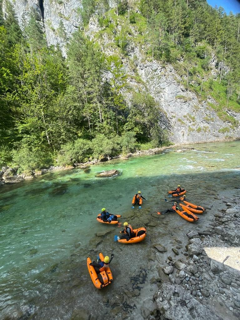
Czechoslovakian guesthouse in Wildalpen offering rafting, canyoning, riverbug, kayak courses for beginners and rental of paddling equipment.![]()
Black Sheeps Adventures KG
Kühbachau 170
8924 Wildalpen
Tel: +43 650 6346967 or +43 680 2190118
Email: info@black-sheeps.eu
www.black-sheeps.eu
Article on Padler.cz and other photos:
https://www.padler.cz/turistika/35885-salza-perla-mezi-rakouskymi-rekami/